With a focus on actionable insights and strategic value, The Business Research Company’s 2026 market reports include market attractiveness scoring, total addressable market sizing, company benchmarking matrices, interactive Excel dashboards, deeper supply chain intelligence, emerging startup tracking, and granular product-level insights.
Satellite Photography Service Market Size Outlook: A $8.4 Billion Market By 2030, Growing At 11.3% Annually
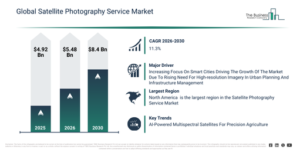
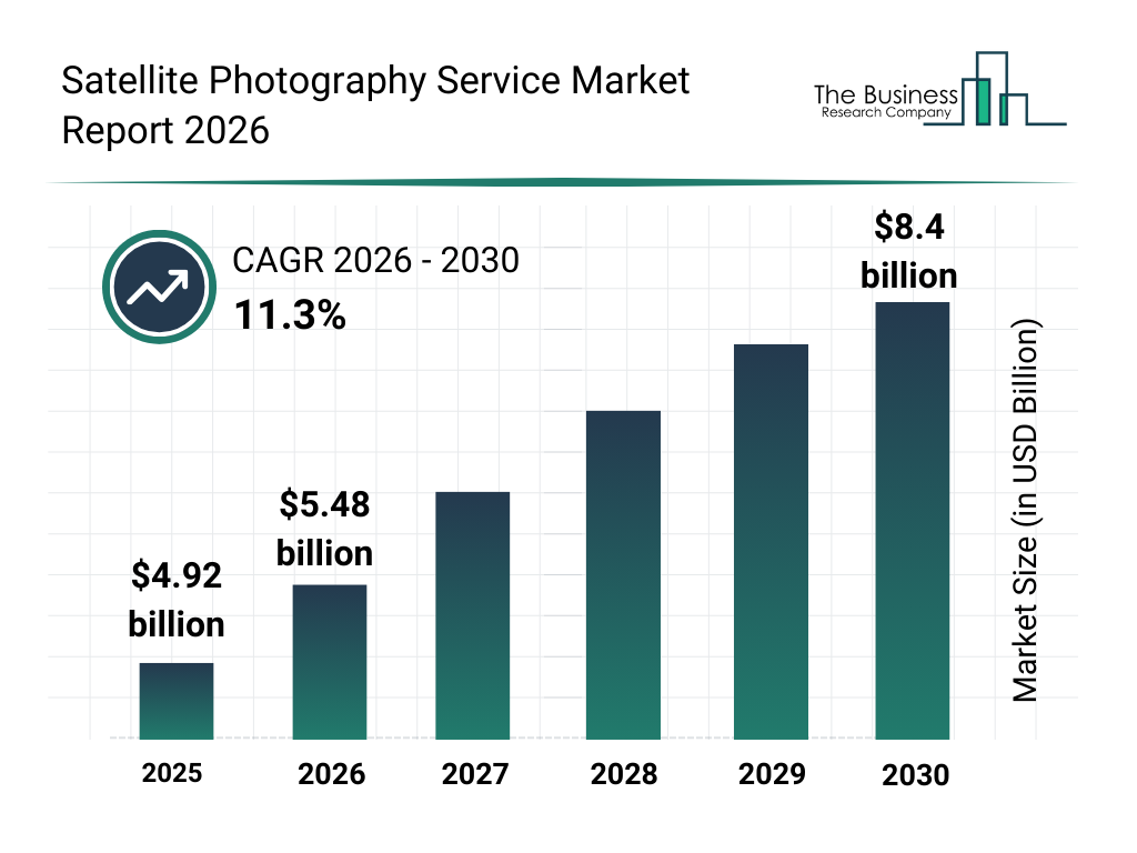
The satellite photography service market size has experienced rapid expansion in recent years. Projections indicate it will advance from $4.92 billion in 2025 to $5.48 billion in 2026, reflecting a compound annual growth rate (CAGR) of 11.4%. This historical growth can be linked to several factors, including growth in earth observation programs, adoption of high-resolution imaging sensors, increasing use in natural resource management, rising demand from mining and exploration sectors, and expansion of maritime and environmental monitoring applications.
The satellite photography service market is projected to experience substantial expansion in the coming years, reaching $8.4 billion in 2030 at a compound annual growth rate (CAGR) of 11.3%. This projected growth is primarily driven by advancements in multi-spectral and hyperspectral imaging, the increasing availability of commercial satellite imagery services, a growing need for real-time imagery analytics, the incorporation of AI for automated image processing, and collaborations with geospatial analytics and mapping firms. Key developments expected during this period involve a heightened demand for high-resolution and multispectral satellite images, expanded application of satellite photography for resource management, the growing integration of satellite imaging in maritime monitoring, broader utilization of satellite technology for exploration in the mining and oil & gas sectors, and an escalating requirement for large-scale environmental and disaster assessment.
Make Data-Driven Decisions With A Free Satellite Photography Service Market Sample Report:
Key Demand Driver Expected To Lift Satellite Photography Service Market Revenue
The increasing emphasis on smart cities is projected to drive the expansion of the satellite photography service market in the future. Smart cities are defined as urban areas that utilize digital technologies, data, and intelligent infrastructure to improve efficiency, sustainability, and the overall quality of life for their inhabitants. This rising focus on smart cities is attributed to the growing necessity for sustainable urban infrastructure capable of efficiently managing rapid population growth and resource consumption. Satellite photography service finds application in smart cities by providing high-resolution imagery essential for urban planning, infrastructure monitoring, and effective resource allocation. For instance, in April 2023, according to the Smart City Index Report published by IMD Business School, a Switzerland-based business school, the number of smart cities saw an increase of 16.3%, rising from 118 cities to 141 in 2023. Thus, the heightened attention on smart cities is a key driver for the growth of the satellite photography service market.
Exploring The Satellite Photography Service Market Through Its Key Segments
The satellite photography service market covered in this report is segmented –
1) By Service Type: Data Acquisition, Data Processing, Data Analysis, Other Service Types
2) By Delivery Mode: Cloud-Based, On-Premises
3) By Satellite Type: Low Earth Orbit (LEO), Medium Earth Orbit (MEO), Geostationary Orbit (GEO)
4) By Application: Agriculture, Environmental Monitoring, Military And Defense, Oil And Gas, Construction
5) By End User: Aerospace And Defense, Energy, Govement Agencies, Retail, Research And Education
Subsegments:
1) By Data Acquisition: Optical Imaging, Radar Imaging, Thermal Imaging, Multispectral Imaging, Hyperspectral Imaging
2) By Data Processing: Image Correction, Image Enhancement, Georeferencing, Orthorectification, Data Conversion
3) By Data Analysis: Land Use And Land Cover Analysis, Environmental Monitoring, Disaster Management Analysis, Agricultural Monitoring, Urban Planning Analysis
4) By Other Service Types: Consulting Services, Custom Mapping, Data Integration, Cloud Storage Services, Training And Support
New Trends Redefining Competition In The Satellite Photography Service Market
Prominent companies operating in the satellite photography service market are prioritizing the integration of artificial intelligence, particularly through AI-powered multispectral imaging satellites, to enhance precision agriculture and environmental oversight. These advanced Earth observation satellites are equipped with cameras capable of capturing multiple spectral bands, utilizing artificial intelligence to accurately analyze crop health, soil conditions, and changes in land. For example, in January 2023, EOS Data Analytics, a US-based satellite imagery and geospatial analytics company, introduced EOS SAT-1. EOS SAT-1 features 11 spectral bands specifically for agriculture monitoring, allowing farmers to improve yields by early detection of crop stress and optimizing the use of fertilizer and water, which reduces costs and environmental footprint, and additionally supports global sustainability by bolstering food security and responsible land management.
Satellite Photography Service Market Competition: Key Players And Industry Participants
Major companies operating in the satellite photography service market are Airbus Group, Planet Labs PBC, ICEYE Ltd., Spire Global Inc., BlackSky Global LLC, EOS Data Analytics, Capella Space Corp., Pixxel Inc., Synspective Inc., GHGSat Inc., Satellogic S.A., Earth-i Ltd., Antrix Corporation Limited, Astro Digital Inc., SI Imaging Services Co. Ltd. (SIIS), GeoIQ Inc., SkyWatch Inc., Maxar Technologies Inc., MDA Ltd., Orbital Insight, Ursa Space Systems, Satellogic North America, European Space Imaging, Imagesat International, e-GEOS S.p.A.
Get The Detailed Satellite Photography Service Market Research Report Here:
Satellite Photography Service Market Regional Overview: Largest Market And Global Coverage
North America was the largest region in the satellite photography service market in 2025. Asia-Pacific is expected to be the fastest-growing region in the forecast period. The regions covered in the satellite photography service market report are Asia-Pacific, South East Asia, Western Europe, Eastern Europe, North America, South America, Middle East, Africa.
Reach Out To Our Team:
The Business Research Company: https://www.thebusinessresearchcompany.com/
Americas: +1 310-496-7795
Asia: +44 7882 955267 & +91 8897263534
Europe: +44 7882 955267
Email us at: marketing@tbrc.info
Follow us on:
LinkedIn: https://in.linkedin.com/company/the-business-research-company
YouTube: https://www.youtube.com/channel/UC24_fI0rV8cR5DxlCpgmyFQ
Global Market Model: https://www.thebusinessresearchcompany.com/global-market-model

Wasay has over a decade of experience in market research, data modelling, and analytics, with prior experience at GlobalData and Decision Tree Consulting Services. At The Business Research Company , he leads research operations across syndicated studies, customized consulting engagements, and the Global Market Model platform. His professional experience includes supporting organizations such as Boston Consulting Group, KPMG, and Ernst & Young. Wasay holds a degree in Electronics and Communications Engineering, postgraduate management qualifications from International Management Institute Belgium and Indian School of Business and Entrepreneurship, and completed the Integrated Program in Business Analytics from Indian Institute of Management Indore.